“‘There may be worse weather, from time to time, at some forbidding place on Planet Earth, but it has yet to be reliably recorded’.
-William Lowell Putnum, on the weather on Mt. Washington
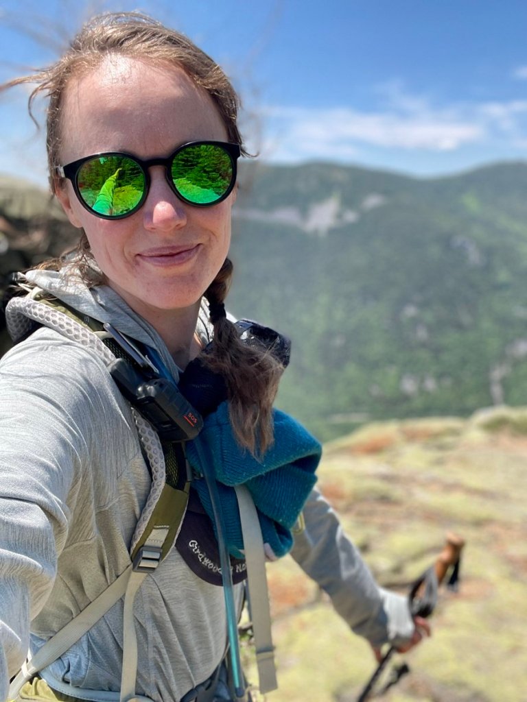
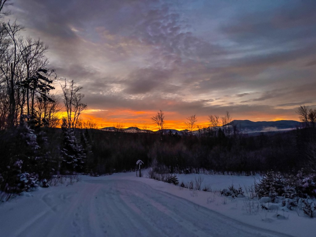
Happy Summer Solstice! Below is an unrolled and expanded story of my Summer Solstice 2022 hike over the Presidential Range in New Hampshire’s White Mountains, originally shared on Twitter. This hike was a huge learning experience for me. In retrospect, it was critical in opening up my comfort level with cold weather adventuring. Hope you enjoy!
Preface
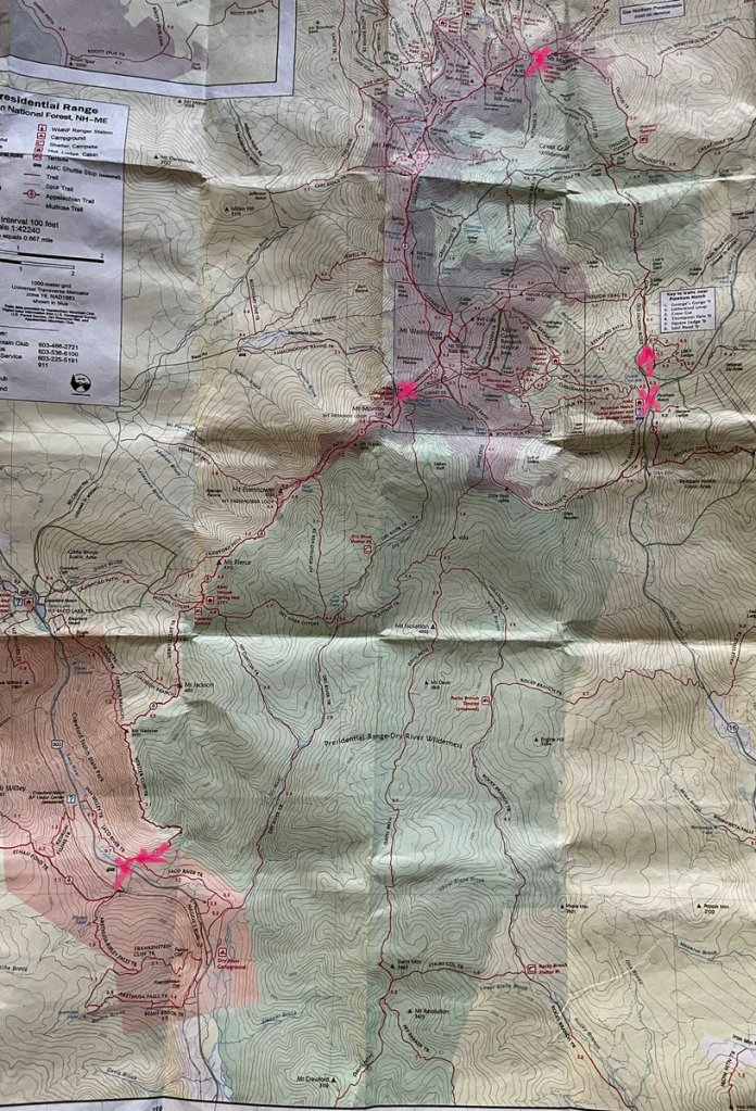
The Presidential Range is a mountain range located in the White Mountains of New Hampshire. Containing the highest peaks of the Whites, its most notable summits are named for American presidents, followed by prominent public figures of the 18th and 19th centuries. The Presidential Range is notorious for having some of the worst weather on Earth, mainly because of the unpredictability of high wind speeds and whiteout conditions on the higher summits. Because of the poor weather conditions, the Presidential Range is often used for mountaineering training for those who go on to climb some of the world’s highest mountains, including K2 and Everest. Mount Washington, long home of the highest winds recorded on the surface of the Earth at 231 mph (372 km/h), is the tallest at 6,288 ft.
One of the great hikes in the White Mountains of New Hampshire is called the Presidential Traverse. It’s so-called because hikers climb all of the mountains in the Presidential Range of the White Mountains in one continuous traversing hike that’s nearly 23 miles long with close to 9,000 feet of elevation gain.
And cleverly…the Appalachian Trail goes right over it.
The Summer Solstice weekend of 2022, I hiked the AT (aka longer) version of the Presidential Traverse. This is a fairly grueling 28 mile route in the best conditions. This weekend was…not the best conditions. Pretty historically rough up there.
I was very thankful I knew the forecast in advance so I could be fully prepared: geared up for the conditions, communicating with folks on the ground, and had planned multiple bail-out and backup options. I’ve got no pride about pushing though past my risk profile: the mountains will always be there another day.
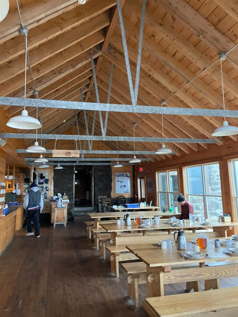
I left Wy&Wo with Auntie. No dogs are allowed in the White Mountain Huts. They are the European style of hiking huts, with a staff, hot meals, and shared bunk rooms. Glamourous compared to the rest of the shelters and lean-tos of the AT, and you pay for it too. A bunk goes for 100$ a night or more. Never has that money been better spent than this weekend….
The morning I left Auntie’s place in CT to head north, I borrowed a couple of extra layers –Id packed my typical “above treeline” overnight pack, minus a couple of items I would have only needed for tent camping. This included full bad weather gear with coats, mittens, extra warm layers, the works. However, the weather reports were further souring hourly, and I was nervous to get caught up above treeline with inadequate gear.
By the time I got up to the mountains, I decided to stop at an outdoor outfitters shop and buy thicker face protection, just to be extra careful. I left my car at the endpoint of the hike and took the AMC Shuttle around to Pinkham Notch. A foot race up the Mount Washington auto toll road was set to kickoff the next day, so the visitor’s center was pretty full with racers who had traveled in for the event. All were watching the weather to see if the race would be cancelled (they ultimately shortened it to go halfway up, due to conditions). I wandered the visitor’s center checking out the large scale 3D topographical model of the range, and listening to phone call after phone call come in. Hikers were calling to inquire about their reservations at the huts up near the summits, and the staff’s advice was consistent: “We strongly recommend to cancel your trip. The conditions will be severe above treeline tomorrow, and safety cannot be guaranteed. We understand this is disappointing but safety comes first. And I’m sorry…there are no refunds.” ‘Cool cool, cool. Let’s get some sleep so we can go up the mountain tomorrow.‘
**Buys a pair of mountaineering mitts on my way out of the visitor’s center**
Day 1
After a big hot breakfast at the Center, I grabbed my pack and prepped to start up the AT route toward Mt. Madison. I only saw one person outside on my way out of the Visitor’s complex–a staff member. “Heading up?” he inquired skeptically. I replied non-committally: “Yeah, I’m going to start up at least and see how it goes. Prepared to turn around if I need to!” He offered me good luck and turned back inside.
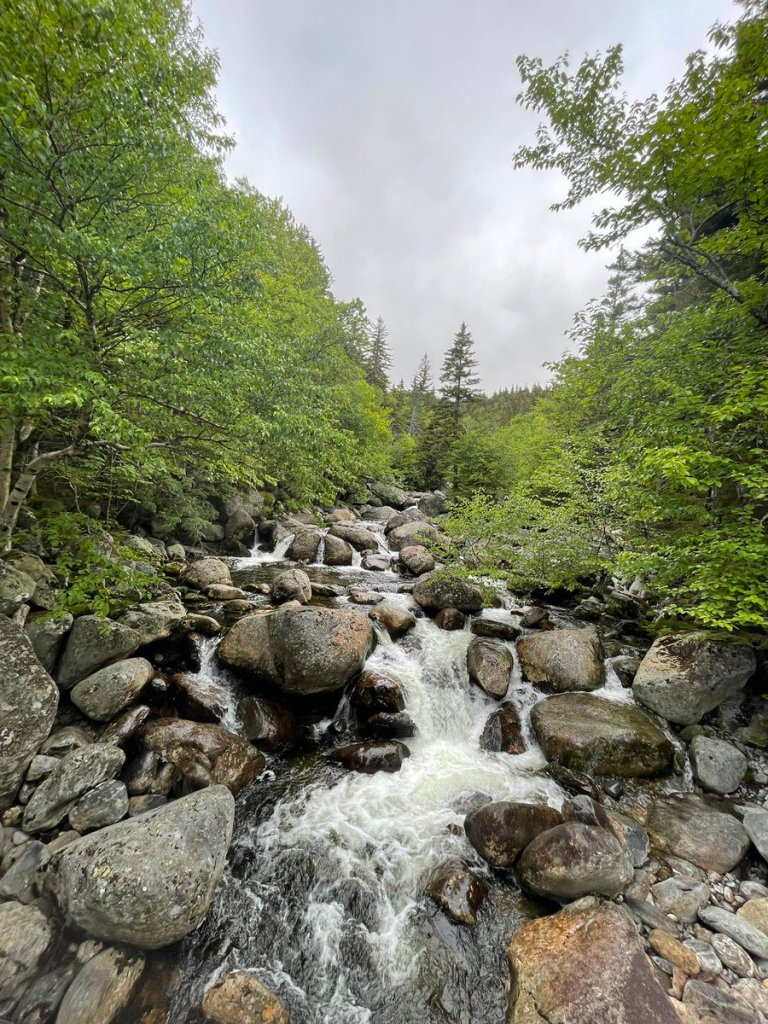
My Day 1 itinerary was easy on paper: Pinkham Notch Visitor’s Center to Madison Springs Hut is just under 8 miles. It started with a few easy miles through the woods, with gradual rolling ascent toward Osgood tentsite, followed by a couple of miles steady ascent but still within tree cover (feeling good!).

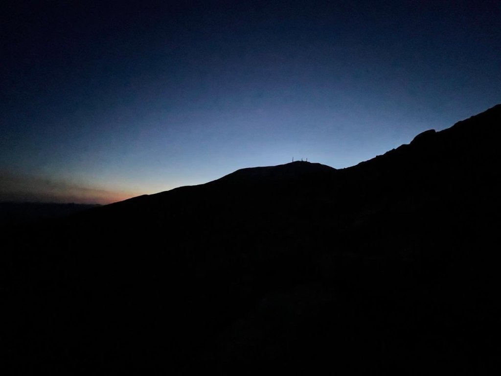
But then…the ridgeline. I stopped just below to add my wind layers and gird my loins, then popped above tree cover and met the famous exposed Alpine Zone. On a nice day, this can mean bluebird skies and panoramic views across the range and beyond. Today, this meant gusts of wind blasting and buffeting me nearly off my feet. And climbing Madison was the leeward side of the system–I was still semi protected by Washington, Jefferson, and Adams, higher peaks between me and the wind source.
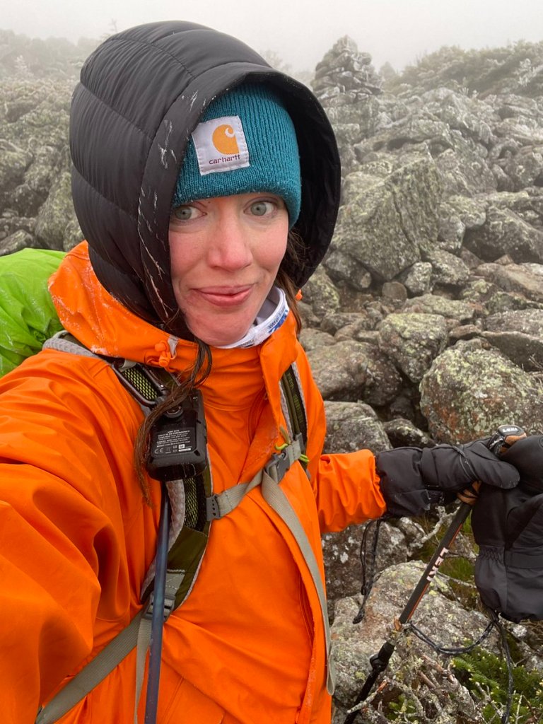
The video below was in the leeward shoulder of Madison–under protection from the Madison’s peak itself which was offering pretty full shelter from the wind. A brief moment of reprieve; as usual, the truly shitty parts rarely get documented for safety reasons! Due to conditions and traveling solo, I opted to take the Parapet Trail which circumvents the summit of Mt. Madison. Its a few tenths of a mile longer to the shelter, but less fully exposed. Even so, starting just after this video, my last leg above treeline had near-zero wind chill, 70+mph gusts, and freezing rain driving UP the mountain. There was zero cover as I scrambled over large boulders with <1/16 mile visibility. The conditions were the worst I’d experienced to that point in my life. I almost couldn’t believe it–the conditions were shocking to me, for June. I instantly understood how people regularly die on these mountains. Needless to say, no pics of that part.
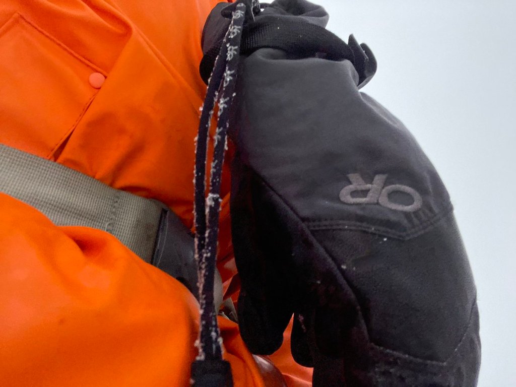
I showed up at the shelter buffeted, with my zero degree mountaineering gloves still holding warmth but getting fairly soaked. This was after my standard safety pair had been abandoned into my pack. I passed through one scraggly stubborn small grove of trees and used the cover opportunity to change out of my heavy-duty hiking gloves, soaked through, into those mountaineering mitts. Good call, past me..
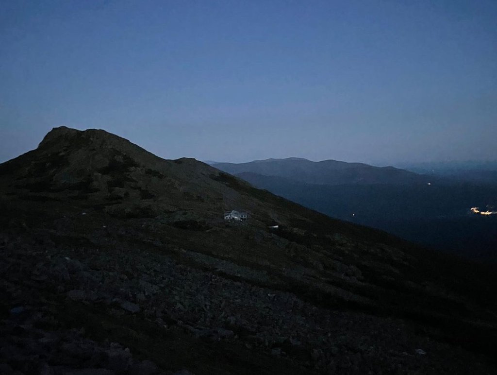
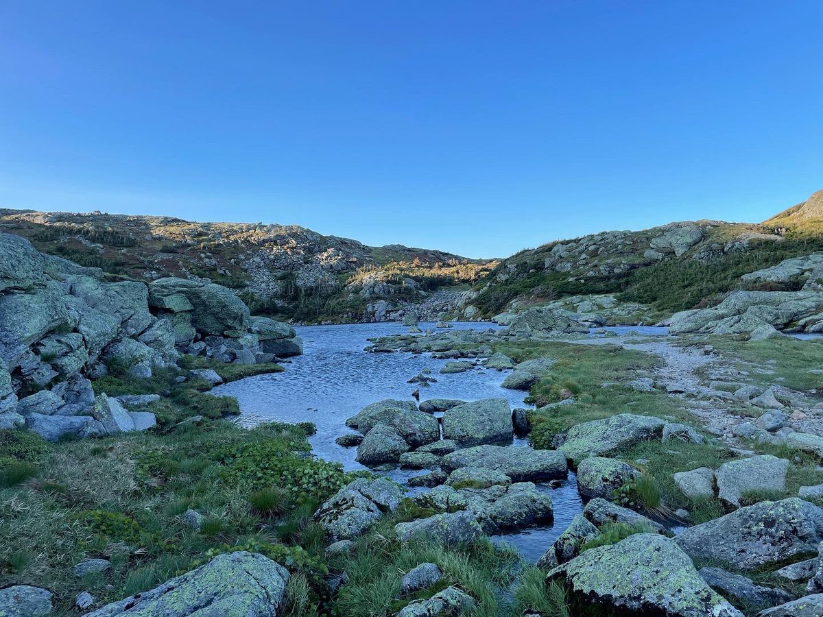
I went slow and carefully to minimize risk of any injury, as I hike solo and I knew I wouldn’t/couldn’t be rescued if something went wrong. Those last 1.5 miles took 1.5 hours, and that was with taking the bypass around the summit. Needless to say, a lot of coffee was consumed when I got to Madison Springs Hut to dry out and spend the night! The hut is sited in a saddle between summits. The hut itself is on a plateau with an Alpine lake and, usually, a stunning view of Madison’s summit. Zero view from the hut today! But at least from the hut there is a fairly-well protected bail-out route down the mountain back to the base. I figured I’d spend the night as planned, and see what the morning brought.
If you’ve never had a chance to stay in the AMC Huts, I cannot recommend it enough. They make the higher alpine areas of the White Mountains much safer and more accessible. A one night reservation gets you a hot dinner and breakfast, and a dry and (generally) warm bed for the night (BYO-sleeping bag). That said…the huts are not heated, per se. While it was much warmer inside the hut than outside in the howling sleeting gale, the few intrepid hikers coming through were staying bundled up inside as they tried to get from soaked to merely damp for descents back down to warm cars. I sat wrapped up in my sleeping quilt, chatting with one or two members of the hut staff (called hut Croo) and volunteer host and enjoying cup after cup of hot coffee and tea. After a hot meal with a small, hardy group, I tucked in for a slightly chilly night in the Madison Springs bunkhouse. Dry, safe…and very very full.
DAY 2
Madison Spring hut sleeps 52; the 14 souls who made it Saturday took in the dodgy weather report and adjusted plans accordingly, as we listened to the wind howl outside the windows still obscured in clouds.
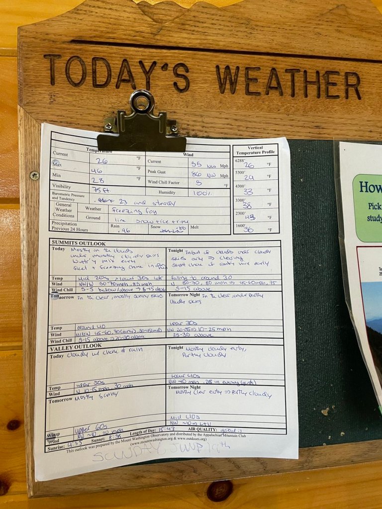
I was the only one who decided to attempt the High Presidential ridge (the ‘traverse’ of Presidential Traverse). Everyone else bailed, heading straight down to the base. As part of this decision, I pre-determined not to turn off on any summit loops. Instead, I made a pledge to stick to the Appalachian Trail route, which strings together each peak but bypasses the true summits by a couple hundred feet of vertical. There are half a dozen bail out options in the first 3 miles, I wasn’t sure how it would go but knew I could turn down if I felt that I needed to. I spent breakfast memorizing the bail-out trail network and saving the AMC shuttle schedule to my phone. I left the shelter at 7:45. Though I didn’t know it, my timing was perfect. A lull in the weather was beginning at about 8am—a 4-hour window with quieted wind and no precipitation.

After a few minutes, I noted the reduced wind and began wondering if I was somehow temporarily sheltered. But it kept…not picking up. The relative quiet was…lovely. I got to my first turnoff at Mt. Adams to Thunderstorm Junction (video) and was feeling really good. Onwards! A bit farther past Adams, the wind was still reducing. What luck! The gusts were minimal and baseline winds were probably down to 25-30mph, since I was somewhat protected just below the summits.
I hooked around behind Jefferson, crossing over a patch of snow still remaining from Winter. I was at the next mountain, in front of Clay, before I saw another single soul and this was 4 miles into the traverse. The Presidential range is one of the most popular hiking routes on the east coast, I can’t imagine I’ll ever be on this route and have it to myself ever again. It was totally eerie, surreal, and perfectly magical.
Shortly after leaving the other hiker, I found an odd pile of gear on the side of Mt. Clay—trekking poles, gloves, tent spikes… it looked like someone had tripped and not realized they dumped a collection of items out of their pack. I added it all to my pack, to bring to the next hut. My thought was to try and reunite it with the owner, or at least give it to a lost-and-found box for hikers in need.
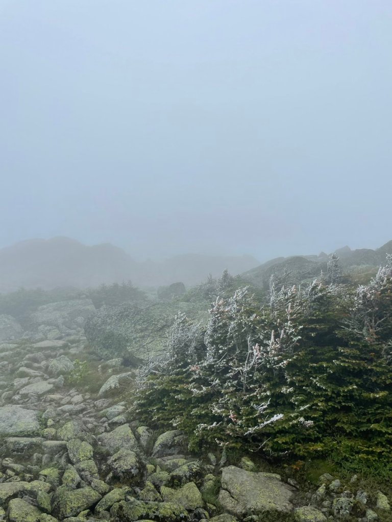
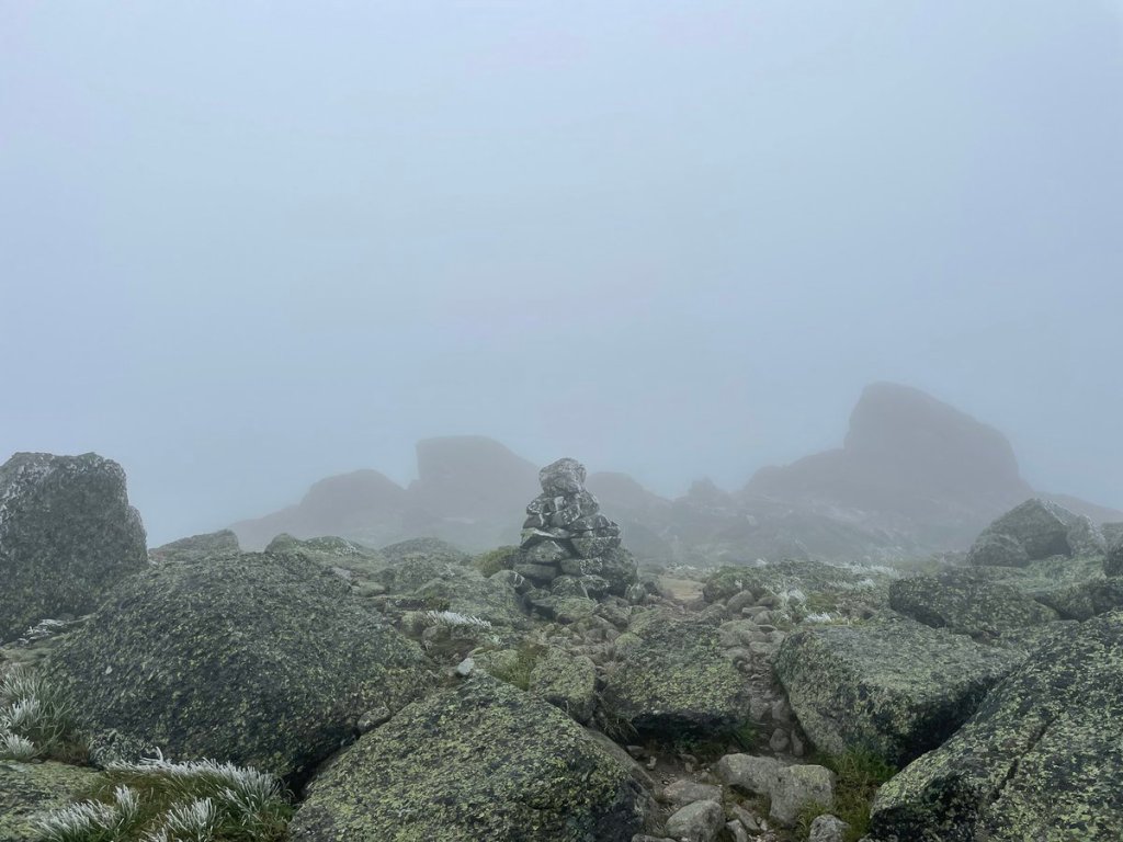
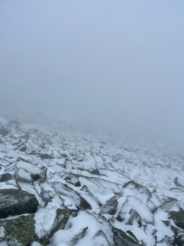
As I finally approached Mt. Washington, the snow and ice coated every surface completely. Visibility was next to zero and the winds really picked up. It was hard to even find the trail at this point, with rock cairn piles still far apart and no ability to scan for the next pile. I followed the rail road tracks for a bit at one point when I lost the trail, before coming back onto it again a few minutes later. That moment was a bit unnerving, but I knew that folks hike the railroad track route from the base to the summit, so as long as I knew my position relative to the tracks I could make it up. Plus, it remained calm with no precipitation, so I was toasty warm, and I was making good time. Sticking with my pledge, I skipped the summit of Washington.
No big views—I couldn’t even see the summit! This is not the surface of Mars, though it felt like it. A brief lull as/after I passed the summit and it provided momentary block from the wind, so…documentation:
The winds were picking back up as I began to drop away from the summit’s protection…and the sleet was picking back up as the weather break was ending. It was another 1.5 miles down to Lakes of the Clouds Hut—my haven for the night. I was glad to be going downhill as the wind whipped around and slowed my progress considerably. I slowed to a crawling pace and carefully picked my way from cairn to cairn. I saw the sign for the hut, which is the only reason I knew I was close–the famous alpine lakes, a mere dozen yards from the trail, were not remotely visible. The peaked roof of the AMC hut became hazily visible through the fog–and very close. I barely saw it before I was stepping up toward the door.
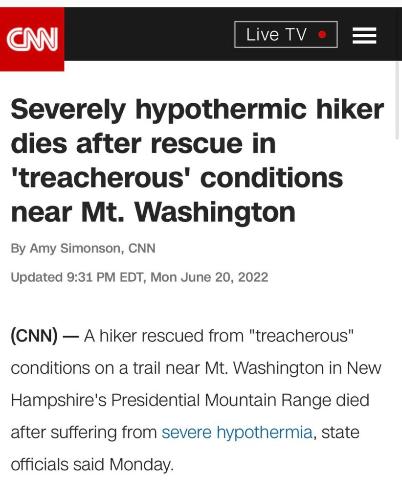
I rolled into the hut’s front door before I remembered my micro-spikes. I put them on first thing when I left Madison Springs in the morning, to give myself traction on the glare rime ice coating the trail. I looked up at the AMC hut Croo member walking over, immediately apologizing for wearing my spikes indoors. He replied exasperatedly “WELL AT LEAST YOU HAVE THEM! You wouldn’t believe what we’ve seen.” I got a quick report that it had been chaos the last 18 hours—unprepared hikers coming in with no alpine gear, insufficient layers, and everything from mild to severe hypothermia. The thru-hikers stuck at the hut from the storm had set up a triage unit in one of the bathrooms to assess and warm up folks on arrival. At least one rescue had been performed off of the mountain the day before–not surprising but unfortunate.
I learned of one particular rescue for hypothermia that happened on Mt. Clay late the night before—right where I’d found the gear pile that morning. It was very likely that I’d recovered his gear, as I was almost certainly the next person on the trail, post-rescue. That individual unfortunately later died and it has made National news. It’s surreal to think those soaked gloves I picked up were part of this sad story.
I’m thankful that my preparation and the conditions allowed me to complete the high Presidentials under these challenging conditions, but I would be equally proud if conditions had been different, or my preparation hadn’t been sufficient, and I’d made the smart call to bail-out.
My hut arrival was marked by swaddling myself in my quilt, lots more coffee and snacks and then, as the clouds began to thin, watching the hail blow up the mountain for the afternoon. Some people had been stuck there for days. Everyone was just waiting on the weather system to clear overnight.
Day 3
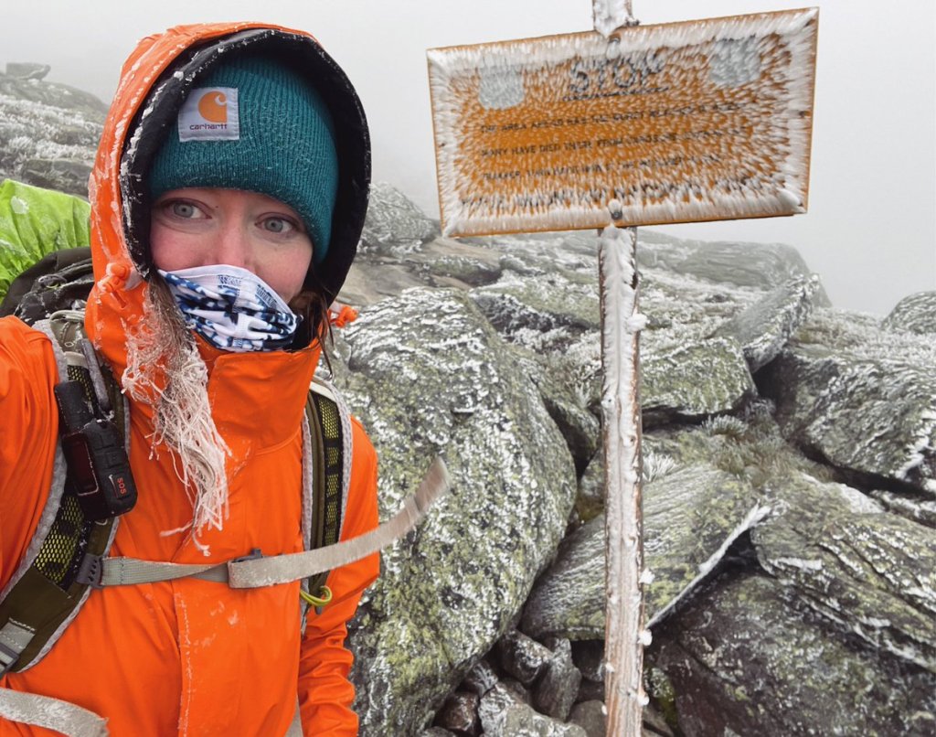
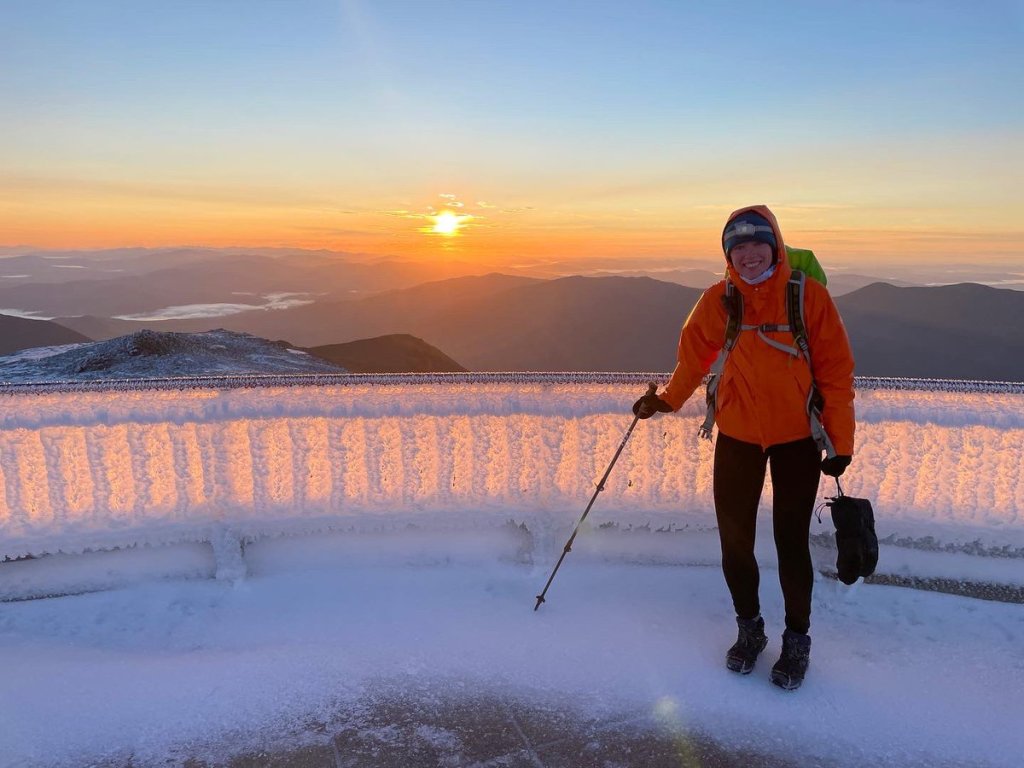
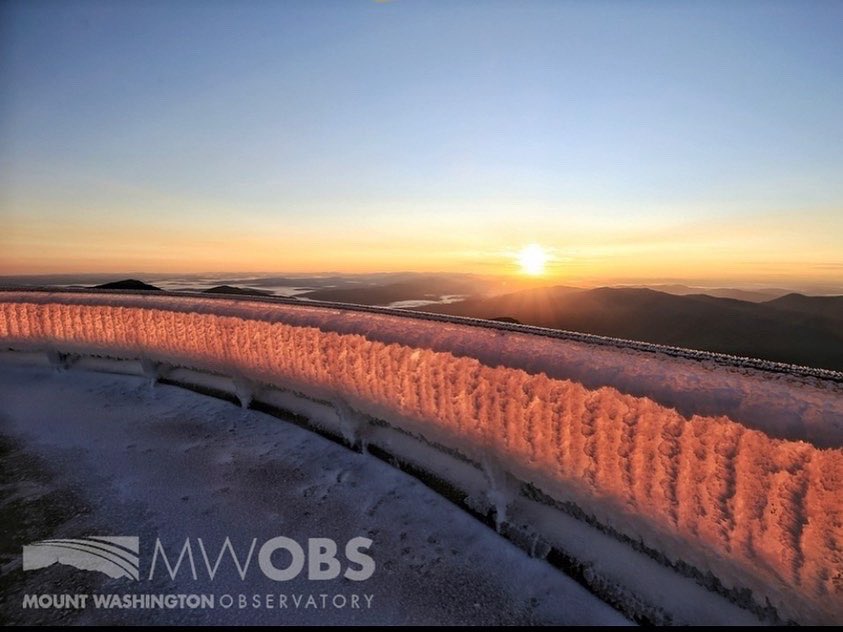
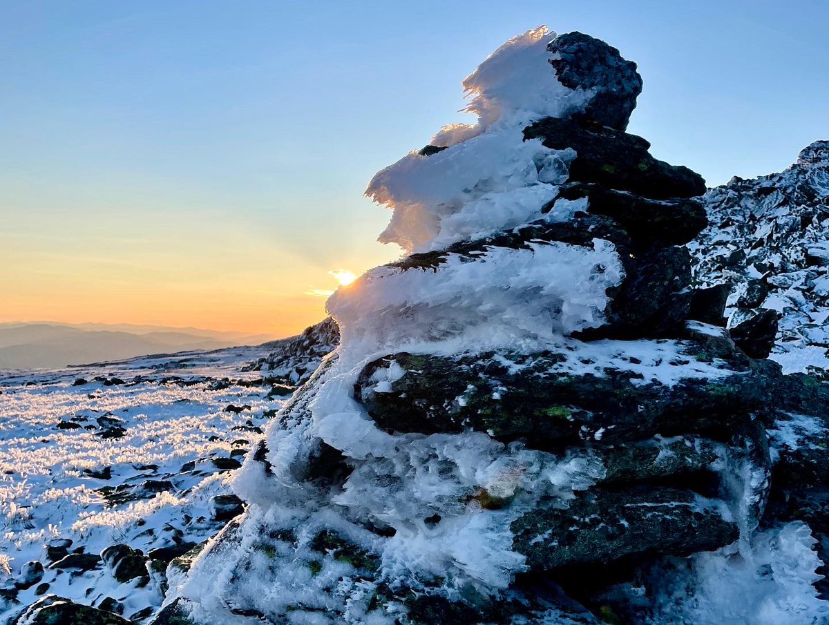
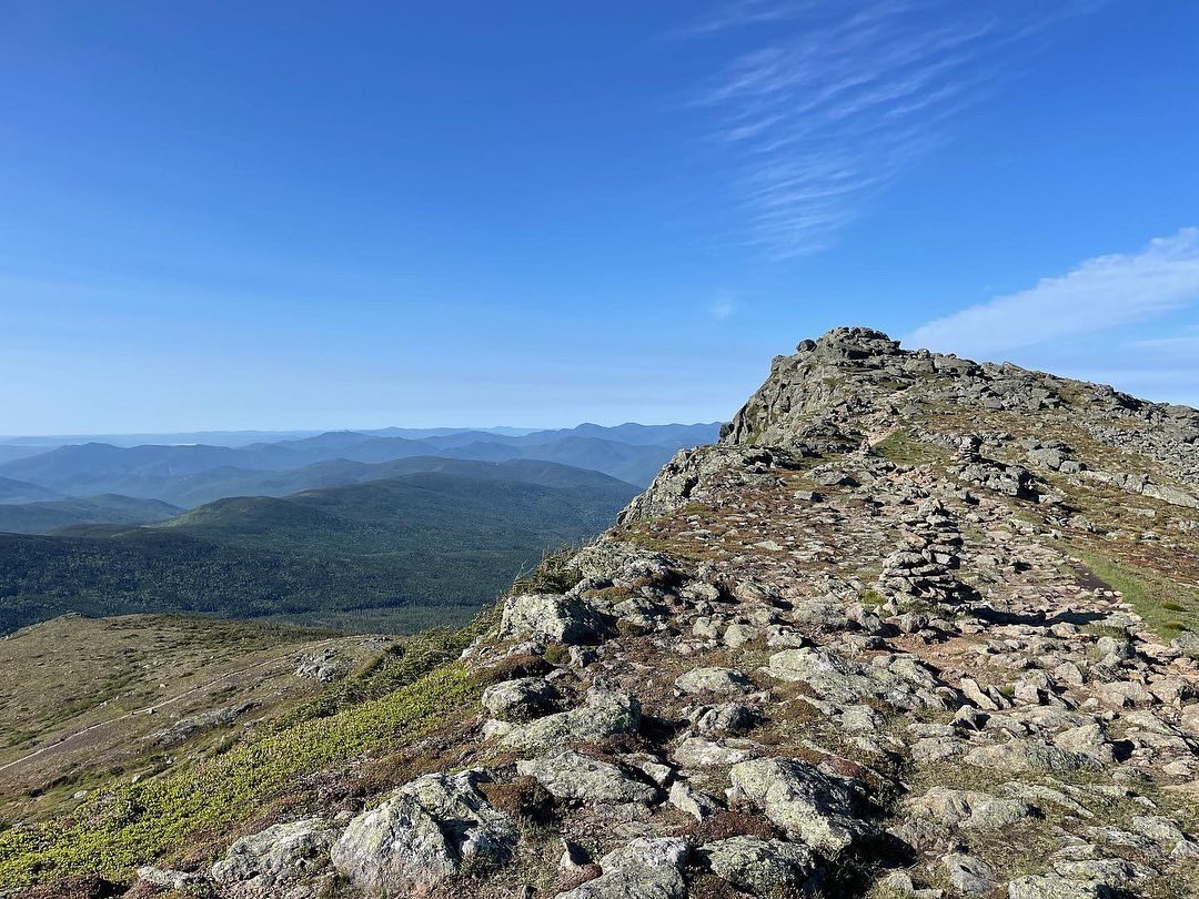
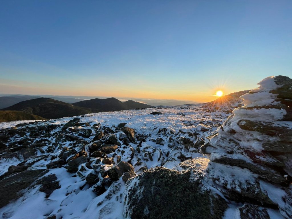
The skies did clear overnight, though the wind remained fierce. At 3:50am, I checked the NOAA observatory weather conditions. Windchill at the summit remained at +5—which was 5 degrees above my lower limit. I’d made a deal with myself the night before that if the skies cleared and it was above zero, it was time to hike up to the summitfor the solstice sunrise!
Friends, it was a magical sunrise.
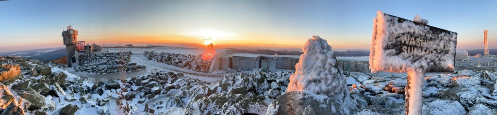
The NOAA Weather scientist came out to take my picture! Well, he came out to take his own picture, but I seized the opportunity. Sorry if I started you, sir. I know you weren’t expecting any company!
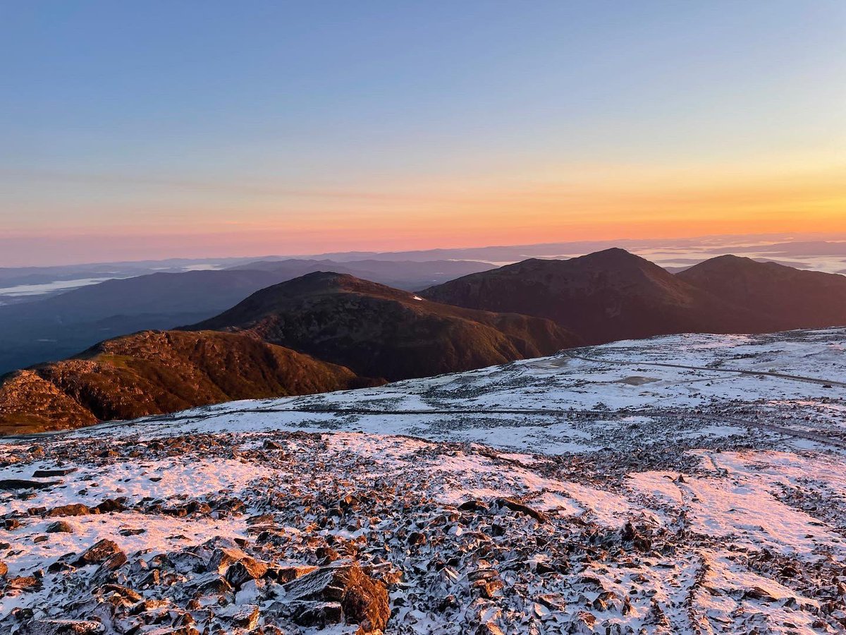
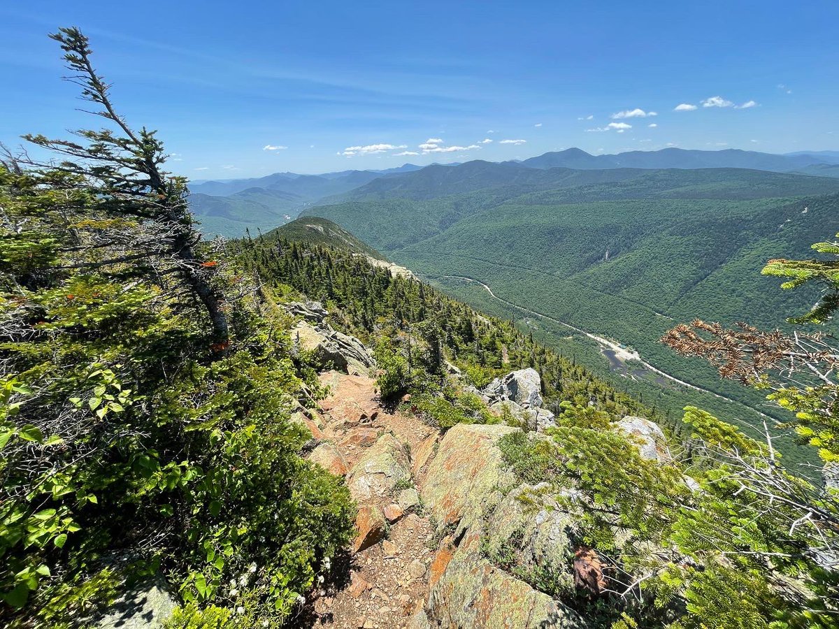
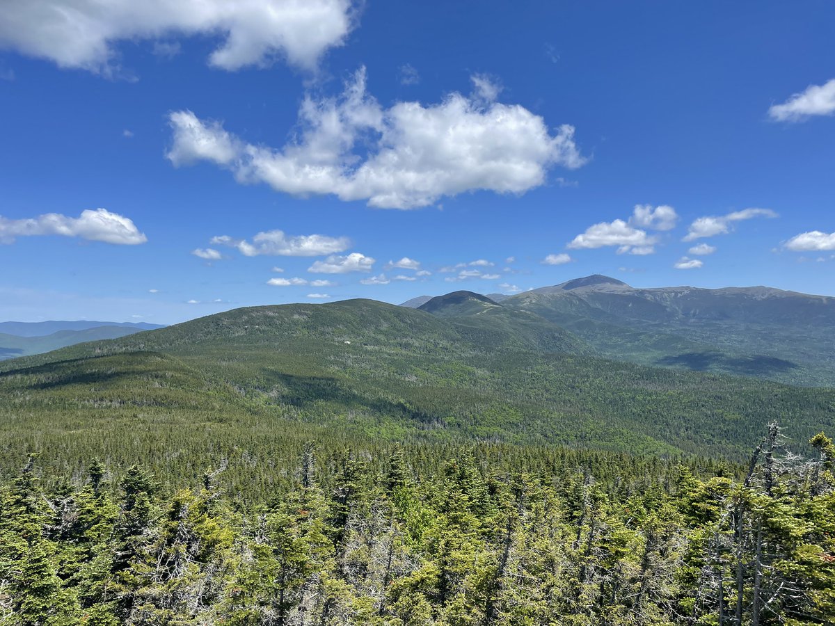
Not only was the rime ice amazing, but the clouds are completely cleared so I could now see back to everything I had (nearly) hiked. From right to left: Madison (& Saturday’s Madison Springs hut not visible in the saddle), Adams & the lesser Adams’, Jefferson, & Clay at far left. The AT stays 100-300’ below the summit of each…for reference, I walked through the snow pile visible on the back of Jefferson in the tweet above. I had stopped to take a snow-pile picture to make Wolfy jealous 😂). The difference, when yesterday I could hardly see to the next cairn pile, was disorienting. I could actually see the Lakes of the Clouds now! It wasn’t tricky…they were less than 50 yards from the shelter hut.
After stopping back at Lakes hut for a hot breakfast, and sharing pics of the sunrise with my fellow hikers (who’d for some reason declined to get up with me at before 4am and hike for an hour to see it, weird!), it was Lower Presidentials day. My car waited 12 mi and many thousands of feet down at Crawford Notch valley. The visibility was astounding—I could see 100+ miles to the peaks we’d climbed on last year on Vermont’s Long Trail.
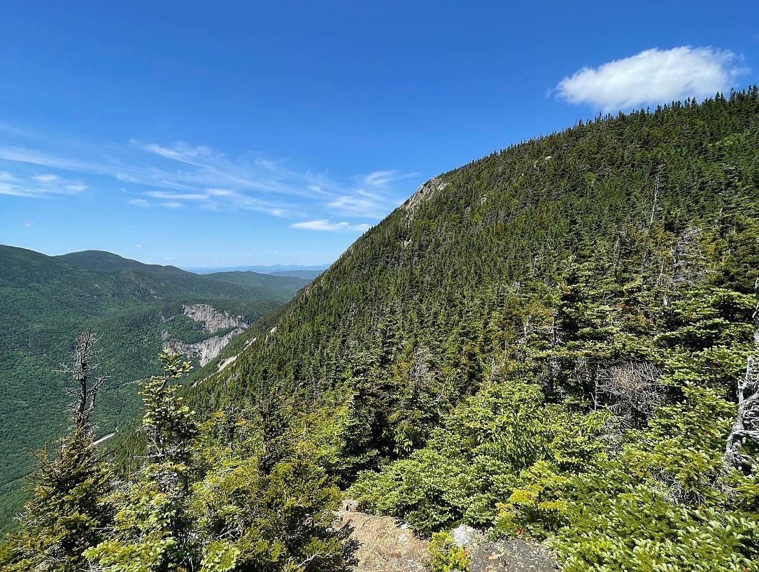
It was a stunning day of hiking, which required shedding a full layer of clothing about once per hour as I dropped in elevation and temperatures flew back up to summer levels. It was disorienting to see day hikers coming up on T-shirts and shorts. Its not nothing–I summited Mt. Monroe, Franklin, Eisenhower, Pierce, and Jackson, and descended the Webster Cliffs–but downhill is much easier. On the descent, it looked like I hiked from the surface of the Moon, to the Swiss Alps, to the Rocky Mountains, and finally back into New Hampshire. That was where the mosquitoes caught up with me.


Once home, I ultimately learned that the hiker rescued off Mt. Clay, whose gear I recovered, didn’t made it. It’s heartbreakingly sad for his family and loved ones. He was an experienced hiker, too. After this weekend, more than ever, I appreciate the fine line of safety in the mountains and how quickly things can turn.
It happened to work out for me that weekend, I was able to stay on-route and I got to have some of the most surreal hiking moments of my life-to-date. I know I am never truly safe while solo-hiking these regions—the best I can do is minimize my risk by maximizing my planning, monitoring continuously, and making well-calibrated choices in the moment. Doing so enables magical, rewarding experiences like this weekend.
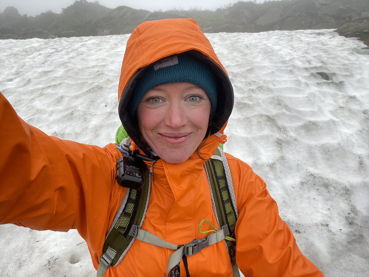
And the comic relief 😂
Thanks for coming along for #rushtokatahdin, Presidential-edition 🤍
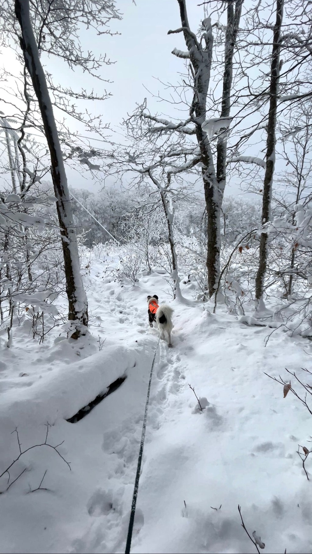
Now, let’s get the dogs back on the trail!!


Leave a reply to Lady Mountaineers! – The TypeTwoFun Club Cancel reply